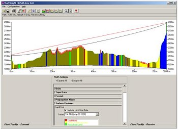
Softwright.com - Using the Terrain Analysis Package includes tower offsets and fresnel zone, based upon historic elevation data of terrain.
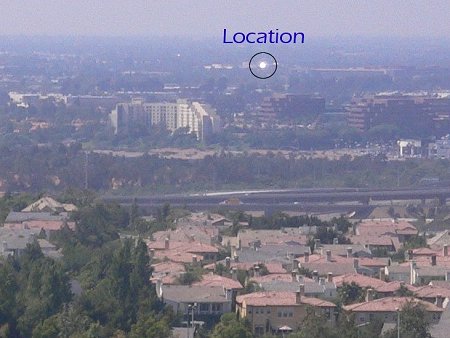
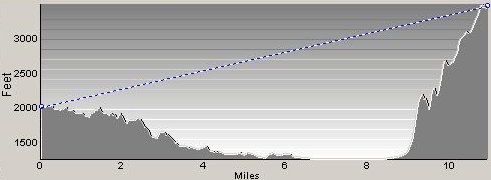
Actual Line-of-Sight Survey performed at each end of proposed path is the best way to insure for reliable operation. This "flash" was performed with an Air Force signal mirror over the 6 mile path. Real world examples of commercial Line-of-Site Surveys are here and here.
About Us | Site Map | Disclaimer & Terms of Use | Contact Us | ©2008 BlueWave Broadband™