Terrain Navigator Pro 8.0
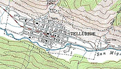
State by State Pricing - Features tower height-offsets for line-of-sight profiles - USGS topo maps are the recognized standard. Maptech
scans official paper maps to produce clear and detailed images of all 58,000+
USGS maps. Each continental US CD-ROM contains up to 300 quads in two scales: 1:24/25,000
(7.5 minute series) and 1:100,000 scale. Terrain Navigator Pro includes a 1-year subscription to access aerial photos via
your normal Internet connection. Any aerial photos you save are yours to keep
after the subscription expires. Has optional street address module. Many features. Great for doing fairly accurate profiles. Sold by 4x4books.com and at gpsnow.com at a discount.
National Geographic Topo!
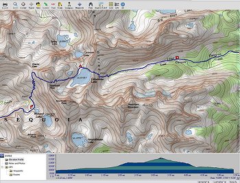
State by state pricing - Nice looking, but not great for profiles - Very colorful topo software designed primarily for recreation. Available at bookstores and on the web.
Softwright TAP
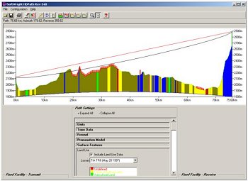
Softwright.com - The developer of the Terrain Analysis Package for Windows XP consists of twenty-five modules that, when combined together, are tools that bring a broad capability of RF system design to your personal computer. Most studies are accessed through one of two main screens - HDPath and HDCoverage. Studies such as reflection analysis, antenna heights, path clearances, and shadow studies are all done within this one screen, assuming you have licensed the appropriate software modules. Professional package in the $3,000 to $4,000 range.
About Us | Site Map | Disclaimer & Terms of Use | Contact Us | ©2008
BlueWave Broadband™